Robot lawn mowers have changed quickly over the last few years.
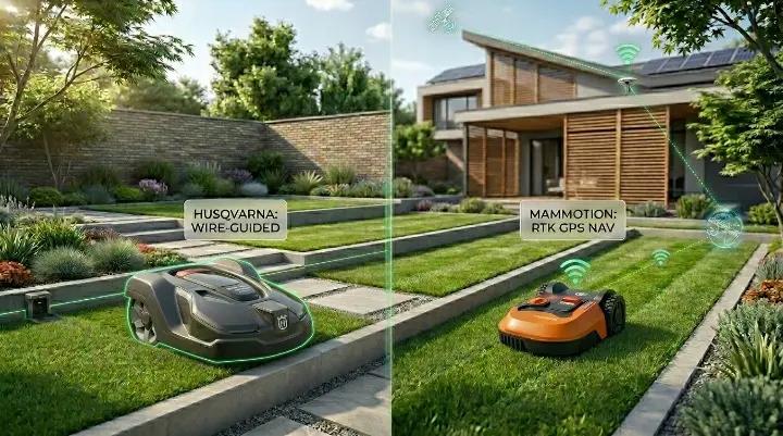
Not long ago, most models relied on boundary wires buried around the edge of the lawn. Today, many wire-free robot mowers use advanced navigation systems that allow them to map, navigate, and mow with little or no physical setup.
The two technologies getting the most attention are RTK and LiDAR.
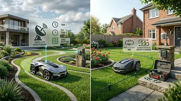
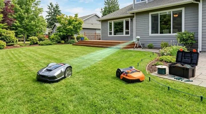
RTK uses satellite positioning and a reference station to guide the mower with very high accuracy. LiDAR uses laser sensors to scan and understand the environment around the mower. Both technologies can eliminate boundary wires, create neat mowing patterns, and automate lawn care.
However, choosing between RTK and LiDAR is not as simple as deciding which technology is newer or more advanced.
A large, open lawn may be a perfect fit for RTK. A yard filled with trees, buildings, and narrow passages may benefit more from LiDAR. At the same time, many of the newest robot mowers are starting to combine multiple navigation technologies instead of relying on just one.
In this guide, we'll explain how RTK and LiDAR work, compare their strengths and weaknesses, and help you determine which navigation system is the better choice for your yard.
RTK vs LiDAR: Quick Comparison
For most homeowners, the biggest differences come down to installation, tree coverage, obstacle handling, and yard complexity.
| Feature | RTK | LiDAR |
| Navigation Method | Satellite positioning with a base station | Laser-based environmental mapping |
| Installation | Requires RTK antenna and setup | Usually simpler setup |
| Performance Under Trees | Can be affected by signal blockage | Generally more reliable |
| Open Lawn Performance | Excellent | Very good |
| Complex Yard Performance | Good | Excellent |
| Obstacle Detection | Depends on sensors used | Often stronger when combined with mapping |
| Mowing Patterns | Precise straight lines | Precise straight lines |
| Large Property Coverage | Excellent | Good to very good |
| Dependence on Sky Visibility | High | Low |
| Typical Cost | Moderate to high | High |
Looking only at the table, LiDAR may appear to be the better technology. In reality, the answer depends on the lawn.
RTK remains one of the most accurate navigation systems available for large open properties. When the mower has a clear view of the sky, it can maintain highly precise positioning and create clean mowing lines across large areas.
LiDAR shines in environments where satellite signals are less reliable. Trees, fences, garages, walls, and other obstacles generally have less impact on a LiDAR-based mower because it can continuously map and interpret its surroundings.
That said, the line between RTK and LiDAR is becoming less clear every year. Many premium robot mowers now combine RTK, LiDAR, cameras, and other sensors to improve navigation in a wider range of conditions.
Before deciding which system is right for your yard, it helps to understand how each technology actually works.
How RTK Navigation Works
RTK stands for Real-Time Kinematic positioning.
In simple terms, RTK helps a robot mower determine its location with much greater accuracy than standard GPS. While ordinary GPS can be off by several feet, RTK systems can often locate the mower within a few inches.
An RTK robot mower relies on three main components:
- GPS satellites
- An RTK reference station (sometimes called a base station)
- The mower itself
The reference station is installed somewhere on the property where it has a clear view of the sky. It receives satellite signals and sends correction data to the mower. By combining satellite positioning with these corrections, the mower can calculate its location very precisely.
This high level of accuracy allows RTK mowers to follow planned routes instead of moving randomly around the lawn. The mower can travel in organized rows, reduce overlap, and cover large areas more efficiently.
For homeowners, one of the biggest advantages is that there is usually no boundary wire to install. Instead, mowing zones, no-go areas, and pathways can typically be created through a mobile app.
RTK technology works especially well in open spaces where both the mower and the reference station can maintain strong satellite reception. Large backyards, wide lawns, and properties with minimal obstructions are often ideal environments.
The challenge is that satellite signals are not equally strong everywhere in a yard.
Tall trees, nearby buildings, garages, retaining walls, and other structures can partially block or reflect GPS signals. In some situations, this may reduce positioning accuracy or cause the mower to temporarily lose its precise location.
That does not mean RTK is unreliable. In fact, many homeowners use RTK mowers successfully in everyday residential lawns. Modern systems are far more capable than early generations, and software improvements continue to reduce signal-related issues.
Still, RTK performs best when the mower has a relatively clear view of the sky. This is one reason manufacturers have begun exploring additional navigation technologies that can help in areas where satellite coverage is less than ideal.
How LiDAR Navigation Works
LiDAR stands for Light Detection and Ranging.
Instead of relying primarily on satellites, a LiDAR-equipped robot mower uses laser sensors to scan and understand the environment around it. The mower continuously measures distances to nearby objects and uses that information to build a map of the yard.
You can think of LiDAR as giving the mower a way to "see" its surroundings.
As the mower moves, it identifies features such as trees, fences, garden beds, walls, pathways, and other landmarks. By comparing these features to its map, the mower can determine where it is and where it should go next.
This approach has a major advantage over satellite-based navigation. Because the mower is using information from the environment itself, it is less dependent on having a perfect view of the sky.
For example, areas under mature trees, beside garages, or near tall fences can be challenging for some GPS-based systems. A LiDAR mower can often navigate these spaces more confidently because it is tracking physical objects around it rather than relying solely on satellite signals.
Another benefit is simpler setup.
Many LiDAR-based mowers do not require a boundary wire, and some models also avoid the need for a separate RTK antenna. In many cases, the initial setup involves guiding the mower around the perimeter of the lawn through an app and allowing it to create a digital map.
LiDAR can also improve navigation in complex residential yards. Narrow passages, irregular lawn shapes, and areas around landscaping features are often easier to map and revisit accurately.
However, not all LiDAR systems work the same way.
Some robot mowers use LiDAR as their primary navigation technology, while others combine it with cameras, RTK positioning, wheel sensors, or other systems. The goal is to improve reliability by allowing multiple technologies to work together.
This distinction is important because a mower equipped with LiDAR is not necessarily a "LiDAR-only" mower. Many of the newest models use a combination of sensors to overcome the limitations of any single navigation method.
As a result, LiDAR is becoming an increasingly important part of modern robot mower design. Rather than replacing every other technology, it is often used to help mowers navigate more reliably in real-world yards filled with trees, buildings, and obstacles.
RTK vs LiDAR in Real-World Conditions
Technical specifications only tell part of the story.
A navigation system that performs perfectly on a product page may behave very differently in an actual yard. Trees, buildings, slopes, landscaping features, and lawn layout all influence how well a robot mower can navigate.
For most homeowners, real-world performance matters more than navigation theory.
Open Lawns
If your yard is mostly open with a clear view of the sky, RTK is often the stronger choice.
RTK systems were designed for this type of environment. With strong satellite reception, the mower can maintain highly accurate positioning across large areas and mow in neat, efficient rows.
This is one reason RTK became popular on larger properties. It allows robot mowers to cover more ground while minimizing missed spots and unnecessary overlap.
LiDAR also works well in open lawns, but its biggest advantages are less noticeable when there are few obstacles to navigate around. In a simple yard with little tree cover, RTK often delivers excellent results.
Tree-Covered Yards
This is where the conversation becomes more interesting.
Trees can partially block satellite signals, especially when the canopy is dense. Large shade trees, groups of mature trees, or wooded property edges may reduce the quality of GPS reception in certain parts of the yard.
In real-world discussions among robot mower owners, signal quality under trees is one of the most frequently mentioned challenges with RTK systems. Some users report no issues at all, while others notice occasional positioning errors in heavily shaded areas.
LiDAR-based navigation is generally less affected because it relies on environmental mapping rather than satellite visibility. As long as the mower can identify landmarks around it, trees usually have a smaller impact on navigation performance.
That does not automatically mean LiDAR wins every time. Some homeowners report excellent RTK performance even under tree cover, while others prefer hybrid systems that combine RTK and LiDAR to handle changing conditions throughout the yard.
If a significant portion of your lawn sits beneath mature trees, LiDAR or hybrid navigation is often worth considering.
Multi-Zone Properties
Many residential properties are divided into separate mowing areas.
You may have a front yard and backyard connected by a narrow passage. Some homeowners also have side lawns, fenced sections, or detached mowing zones around outbuildings.
RTK generally handles large multi-zone properties very well because the mower always knows its position relative to the entire mapped area. Once zones are configured, the mower can travel between them efficiently and follow planned routes.
LiDAR can also manage multiple zones, but performance often depends more heavily on how the mower maps the environment and transitions between areas.
For larger properties with several distinct mowing zones, RTK usually has a slight advantage.
Yards With Buildings and Narrow Passages
Residential lawns are rarely wide-open rectangles.
Many yards include garages, sheds, retaining walls, landscaping features, patios, and narrow passages that connect different sections of the property.
These areas can be challenging for satellite-based navigation because buildings and structures may block or reflect GPS signals.
LiDAR tends to perform well in these environments because it uses physical landmarks for navigation. Instead of depending entirely on satellites, it can recognize walls, pathways, and other nearby features while moving through tight spaces.
This flexibility is one reason LiDAR has gained attention in recent years. Some homeowners find that LiDAR-equipped mowers can navigate around obstacles and return to charging stations in locations that would be difficult for earlier navigation systems.
If your lawn contains many structures or complex landscaping elements, LiDAR often offers a practical advantage.
Sloped Lawns
Many buyers assume navigation technology is the most important factor on hills.
In reality, slope performance is often determined more by the mower's traction, drive system, weight distribution, and wheel design than by whether it uses RTK or LiDAR.
A mower that struggles for grip on a steep slope will have problems regardless of how accurately it knows its location.
Both RTK and LiDAR can work effectively on sloped lawns when paired with a machine designed for hill climbing. Features such as all-wheel drive, aggressive tires, and strong traction control usually matter more than the navigation method itself.
For hilly properties, it is often better to focus on slope ratings and drive capabilities before worrying about RTK versus LiDAR.
Why Hybrid Navigation Is Becoming the New Standard
As robot lawn mowers have improved, one trend has become very clear.
Manufacturers are no longer trying to rely on a single navigation system.
Instead, many newer models are combining multiple technologies such as RTK, LiDAR, cameras, and wheel-based sensors into one system. This is often called hybrid navigation.
The reason is simple. Every navigation method has strengths and weaknesses, and real-world lawns are rarely simple environments.
RTK performs best in open areas with clear sky visibility. LiDAR performs better in complex spaces with trees, buildings, and narrow passages. Cameras and visual systems can help detect obstacles that neither RTK nor LiDAR may fully interpret on their own.
By combining these systems, robot mowers can adapt to more situations without relying too heavily on any single input.
RTK + LiDAR in Practice
In a hybrid system, RTK is often used to provide global positioning. It helps the mower understand its general location across the entire property.
LiDAR then adds local awareness. It helps the mower understand what is immediately around it, such as trees, garden edges, fences, or furniture.
Together, they create a more stable and flexible navigation experience.
For example, the mower may use RTK to follow a planned mowing route across a large open lawn. When it approaches a more complex area with trees or structures, LiDAR can help it adjust its movement in real time.
This combination reduces the weaknesses of each system when used alone.
Real-World Direction of the Industry
Hybrid navigation is not just a marketing idea. It reflects how robot mowers are being used in real homes.
Most residential lawns include a mix of open space and complex areas. Very few properties are purely open fields or fully obstacle-filled gardens.
This mixed environment is exactly where hybrid systems perform well.
Some newer robot mower platforms already integrate multiple navigation technologies as standard, and this approach is expected to become more common in the coming years.
Well-known manufacturers such as Husqvarna with its EPOS system and newer brands like Lymow are moving toward multi-sensor navigation strategies rather than single-method solutions.
What This Means for Buyers
For homeowners, the rise of hybrid navigation changes how the buying decision should be made.
Instead of asking whether RTK or LiDAR is better, a more practical question is whether a mower can handle your entire yard reliably.
If your lawn is simple and open, a strong RTK system may still be enough. If your yard has trees, narrow sections, or mixed terrain, LiDAR or hybrid systems can reduce navigation problems.
In many cases, hybrid models offer the most balanced performance because they are designed to handle both open and complex environments within the same property.
Which Type of Robot Mower Should You Choose?
At this point, the choice between RTK and LiDAR is less about which technology is better and more about how your yard behaves in real life.
Most residential lawns are mixed environments. They include open grass, shaded areas, trees, narrow passages, and structures like garages or fences. Because of this, the “best” system depends on which conditions dominate your property.
Below is a simple way to decide based on real-world yard types.
Choose RTK If...
RTK is a strong choice when your yard is mostly open and easy to map.
It works best when the mower can maintain a clear view of the sky and does not frequently move under heavy tree cover or between tall structures.
- ✔Your lawn is large and open with minimal trees
- ✔You want highly structured mowing patterns in straight lines
- ✔Your property has good satellite visibility most of the time
- ✔You prefer strong performance for wide-area coverage
RTK systems are especially effective on suburban or rural properties where the landscape is not heavily obstructed.
Choose LiDAR If...
LiDAR is often a better fit for more complex residential yards.
It handles environments where satellite signals may be weaker or less consistent, and it can adapt more easily to physical obstacles in the lawn.
- ✔Your yard has many trees or shaded areas
- ✔You have narrow passages or irregular lawn shapes
- ✔Your property includes fences, walls, or garden structures
- ✔You want easier setup without relying heavily on satellite signal quality
LiDAR is particularly useful in yards where conditions change frequently across different sections of the property.
Choose a Hybrid Model If...
Hybrid systems are designed for homeowners who want the most flexibility.
They combine multiple navigation technologies so the mower can switch between them depending on the environment.
- ✔Your yard includes both open and heavily shaded areas
- ✔You want fewer navigation limitations overall
- ✔You prefer a “future-proof” system with multiple sensors
- ✔You are managing a medium to large property with mixed terrain
Hybrid models reduce the need to compromise. Instead of optimizing for one type of environment, they aim to perform consistently across all of them.
In many modern robot mower discussions, hybrid navigation is increasingly seen as the most balanced option for everyday homeowners.
However, it is still important to match the mower to your specific yard rather than assuming the most advanced system is automatically the best choice.
Final Verdict
For most homeowners in 2026, the decision between RTK and LiDAR is no longer a simple “which one is better” question.
Both technologies work well, but they are designed for different yard conditions.
RTK remains one of the best options for large, open lawns with strong satellite visibility. It delivers highly accurate positioning and efficient mowing patterns when the environment is simple and unobstructed.
LiDAR performs better in more complex residential yards. It is less dependent on satellite signals and can navigate more confidently around trees, buildings, and narrow spaces.
However, the biggest shift in the robot mower industry is not that one system is replacing the other. It is that many new models now combine RTK, LiDAR, and other sensors into hybrid systems.
For most buyers, this means the real question is no longer “RTK or LiDAR,” but rather “what type of navigation mix does this mower use, and how well does it match my yard?”
If your lawn is simple and open, RTK is still an excellent and reliable choice. If your yard has many obstacles or mixed environments, LiDAR or hybrid systems will usually provide a smoother experience.